


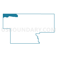
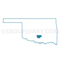
Voting District 1, Garvin County, Oklahoma
About
Outline

Summary
| Unique Area Identifier | 654004 |
| Name | Voting District 1 |
| County | Garvin County |
| State | Oklahoma |
| Area (square miles) | 27.35 |
| Land Area (square miles) | 26.85 |
| Water Area (square miles) | 0.50 |
| % of Land Area | 98.17 |
| % of Water Area | 1.83 |
| Latitude of the Internal Point | 34.83651370 |
| Longtitude of the Internal Point | -97.56739920 |
Maps

Graphs
Select a template below for downloading or customizing gragh for Voting District 1, Garvin County, Oklahoma


Neighbors
Neighoring Voting District (by Name) Neighboring Voting District on the Map
- Voting District 16, Grady County, OK
- Voting District 24, Grady County, OK
- Voting District 26, Grady County, OK
- Voting District 3, Garvin County, OK
- Voting District 4, Garvin County, OK
- Voting District 5, Garvin County, OK
- Voting District 5, McClain County, OK
- Voting District 7, McClain County, OK
Top 10 Neighboring County Subdivision (by Population) Neighboring County Subdivision on the Map
- Purcell CCD, McClain County, OK (17,169)
- Elmore City CCD, Garvin County, OK (5,057)
- Rush Springs CCD, Grady County, OK (3,776)
- Alex CCD, Grady County, OK (3,689)
- Lindsay CCD, Garvin County, OK (2,938)
- Maysville CCD, Garvin County, OK (2,109)
Top 10 Neighboring Place (by Population) Neighboring Place on the Map
Top 10 Neighboring Unified School District (by Population) Neighboring Unified School District on the Map
- Lindsay Public Schools, OK (5,712)
- Maysville Public Schools, OK (2,346)
- Alex Public Schools, OK (1,586)
Top 10 Neighboring State Legislative District Lower Chamber (by Population) Neighboring State Legislative District Lower Chamber on the Map
Top 10 Neighboring State Legislative District Upper Chamber (by Population) Neighboring State Legislative District Upper Chamber on the Map
- State Senate District 24, OK (98,936)
- State Senate District 15, OK (87,049)
- State Senate District 13, OK (73,191)
Top 10 Neighboring 111th Congressional District (by Population) Neighboring 111th Congressional District on the Map
Top 10 Neighboring Census Tract (by Population) Neighboring Census Tract on the Map
- Census Tract 7, Grady County, OK (7,465)
- Census Tract 4002.01, McClain County, OK (3,676)
- Census Tract 6818, Garvin County, OK (2,938)
- Census Tract 6816, Garvin County, OK (2,109)
- Census Tract 6817, Garvin County, OK (1,861)